Seodaemun-gu
Seodaemun District (서대문구, "Great West Gate") is one of the 25 districts of Seoul, South Korea.
Seodaemun has a population of 313,814 (2010) and has a geographic area of 17.61 km2 (6.8 sq mi), and is divided into 14 dong (administrative neighborhoods). Seodaemun is located in northwestern Seoul, bordering the city districts of Eunpyeong to the northwest, Mapo to the southwest, Jung to the southeast, and Jongno to the east.
Seodaemun is part of the Seongjeosimni (Outer old Seoul) area and is named after Donuimun, one of the Eight Gates of Seoul which was formerly located within the district. Seodaemun is home to Seodaemun Independence Park, which contains several historic monuments and buildings such as the Seodaemun Prison museum and the Independence Gate.
Moon Seok-Jin (문석진) of the Democratic Party has been the mayor of Seodaemun since July 2010.
Seodaemun District consists of 14 "administrative dong"s (haengjeong-dong 행정동).
* Sinchon-dong (신촌동 新村洞)
* Daesin-dong (대신동 大新洞)
* Bongwon-dong (봉원동 奉元洞)
* Daehyeon-dong (대현동 大峴洞)
* Changcheon-dong (창천동 滄川洞)
Map - Seodaemun-gu
Map
Country - South_Korea
 |
 |
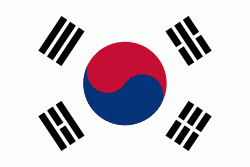
| Flag of South Korea | |
The Korean Peninsula was inhabited as early as the Lower Paleolithic period. Its first kingdom was noted in Chinese records in the early 7th century BCE. Following the unification of the Three Kingdoms of Korea into Silla and Balhae in the late 7th century, Korea was ruled by the Goryeo dynasty (918–1392) and the Joseon dynasty (1392–1897). The succeeding Korean Empire (1897–1910) was annexed in 1910 into the Empire of Japan. Japanese rule ended following Japan's surrender in World War II, after which Korea was divided into two zones; a northern zone occupied by the Soviet Union and a southern zone occupied by the United States. After negotiations on reunification failed, the southern zone became the Republic of Korea in August 1948 while the northern zone became the communist Democratic People's Republic of Korea the following month.
Currency / Language
| ISO | Currency | Symbol | Significant figures |
|---|---|---|---|
| KRW | South Korean won | â‚© | 0 |
| ISO | Language |
|---|---|
| EN | English language |
| KO | Korean language |


